Datei:Canada Newfoundland location map.svg
Zur Navigation springen
Zur Suche springen

Größe der PNG-Vorschau dieser SVG-Datei: 524 × 599 Pixel. Weitere aus SVG automatisch erzeugte PNG-Grafiken in verschiedenen Auflösungen: 210 × 240 Pixel | 420 × 480 Pixel | 672 × 768 Pixel | 896 × 1.024 Pixel | 1.791 × 2.048 Pixel | 824 × 942 Pixel
Originaldatei (SVG-Datei, Basisgröße: 824 × 942 Pixel, Dateigröße: 236 KB)
![]()
Diese Datei und die Informationen unter dem roten Trennstrich werden aus dem zentralen Medienarchiv Wikimedia Commons eingebunden.
![]()
Beschreibung
| Beschreibung |
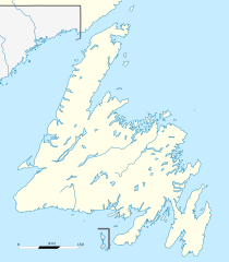
Français : Carte administrative de Terre-Neuve, Canada.
Čeština: Pee Pee Island se nachází v New Foundlandu Projection équirectangulaire. Image étirée N/S de 160%. Coordonnées des bords de carte :
|
| Datum | |
| Quelle | Canada Newfoundland and Labrador relief location map.jpg |
| Urheber | NordNordWest (original map), Flappiefh (cropping, scale and graticules). |
| Andere Versionen |
|

Lizenz
Diese Datei ist unter der Creative-Commons-Lizenz „Namensnennung – Weitergabe unter gleichen Bedingungen 3.0 nicht portiert“ lizenziert.
- Dieses Werk darf von dir
- verbreitet werden – vervielfältigt, verbreitet und öffentlich zugänglich gemacht werden
- neu zusammengestellt werden – abgewandelt und bearbeitet werden
- Zu den folgenden Bedingungen:
- Namensnennung – Du musst angemessene Urheber- und Rechteangaben machen, einen Link zur Lizenz beifügen und angeben, ob Änderungen vorgenommen wurden. Diese Angaben dürfen in jeder angemessenen Art und Weise gemacht werden, allerdings nicht so, dass der Eindruck entsteht, der Lizenzgeber unterstütze gerade dich oder deine Nutzung besonders.
- Weitergabe unter gleichen Bedingungen – Wenn du das Material wiedermischst, transformierst oder darauf aufbaust, musst du deine Beiträge unter der gleichen oder einer kompatiblen Lizenz wie das Original verbreiten.
Dateiversionen
Klicke auf einen Zeitpunkt, um diese Version zu laden.
| Version vom | Vorschaubild | Maße | Benutzer | Kommentar | |
|---|---|---|---|---|---|
| aktuell | 00:13, 28. Nov. 2023 | | 824 × 942 (236 KB) | Tagishsimon | Reverted to version as of 21:06, 8 November 2015 (UTC) |
| 02:03, 3. Sep. 2023 |  | 850 × 921 (166 KB) | Palaeozoic99 | fixed international border | |
| 23:06, 8. Nov. 2015 |  | 824 × 942 (236 KB) | Flappiefh | Removed compass. | |
| 22:58, 8. Nov. 2015 |  | 824 × 942 (244 KB) | Flappiefh | User created page with UploadWizard |
Dateiverwendung
Die folgenden 7 Seiten verwenden diese Datei:
Globale Dateiverwendung
Die nachfolgenden anderen Wikis verwenden diese Datei:
- Verwendung auf ban.wikipedia.org
- Verwendung auf bg.wikipedia.org
- Verwendung auf en.wikipedia.org
- Geography of Saint Pierre and Miquelon
- Paradise, Newfoundland and Labrador
- Holyrood, Newfoundland and Labrador
- Harbour Main-Chapel's Cove-Lakeview
- Avondale, Newfoundland and Labrador
- Conception Harbour
- Colliers, Newfoundland and Labrador
- Whitbourne, Newfoundland and Labrador
- Arnold's Cove
- Come By Chance, Newfoundland and Labrador
- Sunnyside, Newfoundland and Labrador
- Clarenville
- Port Blandford
- Traytown
- Glovertown
- Gambo, Newfoundland and Labrador
- Gander, Newfoundland and Labrador
- Appleton, Newfoundland and Labrador
- Glenwood, Newfoundland and Labrador
- Norris Arm
- Bishop's Falls
- Grand Falls-Windsor
- Badger, Newfoundland and Labrador
- Avalon Peninsula
- Bonavista, Newfoundland and Labrador
- Corner Brook
- Cuper's Cove
- Ferryland
- Belle Isle (Newfoundland and Labrador)
- Upper Island Cove
- Dildo Island
- Stephenville, Newfoundland and Labrador
- Shoal Harbour
- Cape Spear
- Deer Lake, Newfoundland and Labrador
- Channel-Port aux Basques
- Cape Race
- Lawn, Newfoundland and Labrador
- Musgravetown
- Red Bay, Newfoundland and Labrador
- St. Anthony, Newfoundland and Labrador
- Placentia Bay
- Botwood
- Twillingate
- Bell Island (Newfoundland and Labrador)
- Placentia, Newfoundland and Labrador
- Lewisporte
- Conception Bay South
Weitere globale Verwendungen dieser Datei anschauen.